“Accurate 3D winds aloft would be not only a game changer for weather forecasting, but a critical safety measure for pilots worldwide”
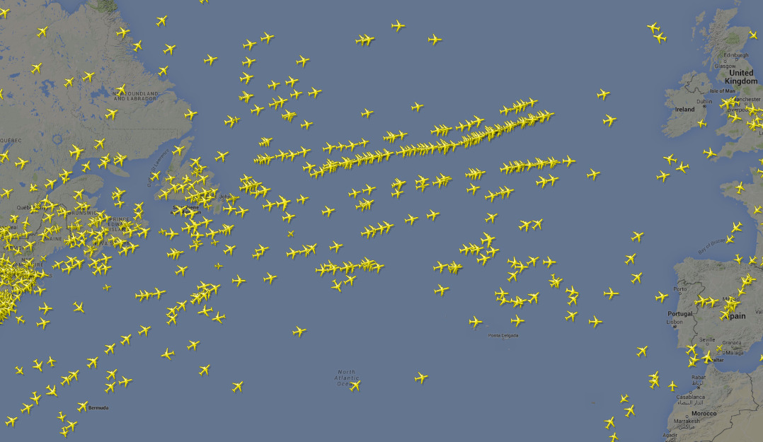
The World Meteorological Organization’s Integrated Global Observing System (WIGOS) consists of a network of more than 10,000 manned and automatic surface weather stations, 7,000 ships, as well as 100 moored and 1,000 drifting buoys providing information on winds and other weather conditions around the globe. Combined with 3,000 specially equipped commercial aircraft measuring key parameters of the atmosphere, one would assume that meteorologists would have sufficient data to forecast wind conditions along the frequently travelled air routes across the globe.
Unfortunately, that is not always the case because of the many large gaps in coverage. Many pilots have firsthand experience with encountering unexpected headwinds during their flights increasing their fuel consumption and delaying their arrivals. This can be especially perilous during long transoceanic flights far from any airport. Even aircraft flying the heavily traveled transatlantic air routes connecting North America and Europe can encounter unexpected headwinds as is related in the story below by former USAF pilot, Chris Reichelt:
“During my 12 years as an US Air Force pilot, often nothing was more important than accurate weather and specifically wind forecasts in accomplishing a mission.
On one particularly harrowing mission, we were flying across the north Atlantic, on our way back home. Prior to departing, we checked the weather as usual. Winds were predicted to be moderate, but not strong enough to warrant fuel concerns while crossing the ocean.
Four hours into our trip, things rapidly began to change. Winds aloft were 175kts in our face. By this point we were well past the mission midpoint, at which we could have turned around and landed back in Europe. We had no choice but to continue westward. We climbed and descended to multiple altitudes in an attempt to reach more favorable winds, as we watch our fuel margin vanish. By the time we were 100 miles out from our landing destination in Canada, we were down to emergency fuel, with unforecasted terrible weather at the landing airport. To say it was a rather tense landing is an understatement, as we had no margin for a second try. Luckily, we landed safely with essentially no fuel left.
Suffice it to say, in aviation, accurate weather models are not only nice to have, but imperative for safety. Accurate 3D winds aloft would be not only a game changer for weather forecasting, but a critical safety measure for pilots worldwide.”
Chris Reichelt, Investment strategist, former USAF pilot

What is needed to prevent situations like this is more data on winds at various altitudes, not only to determine the current state of the atmosphere, but also to improve the forecasting of winds hours into the future. One obvious source of such information is the constellation of existing weather satellites orbiting the Earth but these come up short. Polar orbiting weather satellites only provide a snapshot of cloud cover and other atmospheric conditions with no way to gauge the winds. The existing constellations of weather satellites in geosynchronous orbit, which can monitor cloud motions continuously, can provide wind data but it has low resolution (on the order of tens of kilometers), poor accuracy (with typical uncertainties of several meters/second), and poor discrimination of altitude with the lower 15 or so kilometers of the atmosphere typically divided into three or four coarse altitude bins.
Newer satellites which employ innovative technologies, like ESA’s Aeolus with its Doppler lidar to measure winds which has proven to improve wind forecasts globally, have their limitations (see “How Satellite Wind Data Impacts Weather Forecasting”). The single satellite currently in orbit can measure the winds only along a line to one side of its ground track with profiles from one orbit to the next separated by thousands of kilometers. More detailed satellite data on winds is required to provide substantial improvements in the forecasting of the winds at all altitudes.
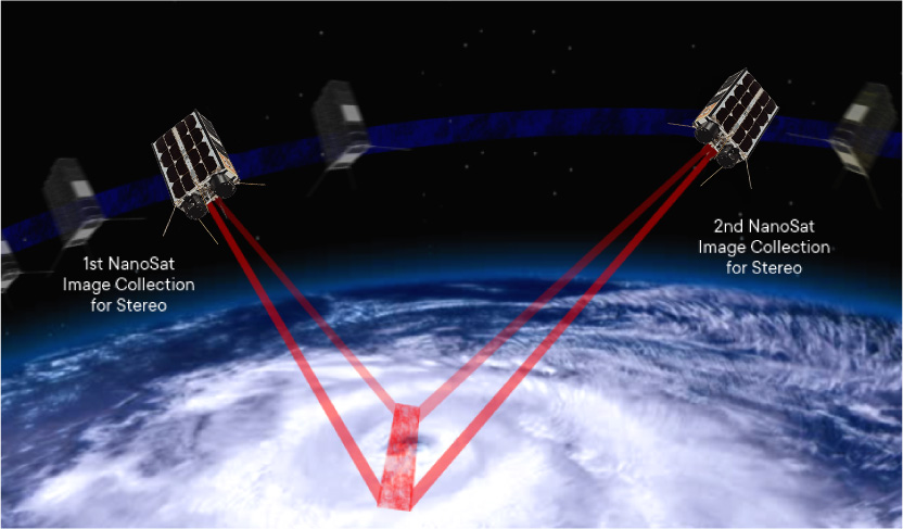
The Hurricane Hunter Satellite constellation, currently under development by Tropical Weather Analytics, Inc., can provide data on winds over large areas with unprecedented resolution and accuracy. Consisting of five pairs of 6U CubeSats with their orbital planes spaced across the globe, this constellation will use its 100-meter class imagery for stereographic analysis to precisely locate not only the latitude and longitude of cloud features in a typical 2,000×2,000-kilometer scene, but also measure their altitudes to an accuracy of 100 meters. By tracking the precise positions of these hundreds of thousands of cloud features as small as 300 to 500 meters over time that are visible in these scenes, the winds can be determined to an accuracy of about one meter/second including unique measurements of vertical winds which no other satellite-based method measures.
With a full constellation of five satellite pairs, any point on the Earth can be observed every 2½ hours to provide information on cloud cover, cloud top altitudes, and 3D winds. Regular observations of heavily traveled air routes across the Atlantic, Pacific, and elsewhere can provide new data on the 3D winds of millions of locations several times a day offering an important new source of data for weather models forecasting the winds across the globe.
The team at Tropical Weather Analytics, Inc. would like to thank Chris Reichelt for giving us permission to relate his story in this forum.
Related Reading
Drew LePage, “The Hurricane Hunter Satellites”, Drew Ex Machina, May 15, 2022 [Post]
Jay Jordano, “The Jet Streams and Their Future Characterization”, TWA Blog, July 18, 2022 [Post]
Drew LePage, “How Satellite Wind Data Impacts Weather Forecasting”, TWA Blog, May 23, 2022 [Post]